Porto Alegre (Porto Alegre)
 |
 |
Porto Alegre was founded in 1769 by Manuel Jorge Gomes de Sepúlveda, who used the pseudonym José Marcelino de Figueiredo to hide his identity; but the official date is 1772 with the act signed by immigrants from the Azores, Portugal.
The city lies on the eastern bank of the Guaíba Lake, where five rivers converge to form the Lagoa dos Patos, a giant freshwater lagoon navigable by even the largest of ships. This five-river junction has become an important alluvial port as well as a chief industrial and commercial center of Brazil.
In recent years, Porto Alegre hosted the World Social Forum, an initiative of several non-government organizations. The city became famous for being the first city that implemented participatory budgeting. The 9th Assembly of the World Council of Churches was held in Porto Alegre in 2006. Since 2000, Porto Alegre also hosts one of the world's largest free software events, called FISL.
The city was one of the host cities of the 2014 FIFA World Cup, having previously been a venue for the 1950 FIFA World Cup.
In the middle of 2010s, Porto Alegre had a growing wave of violence, being ranked as 39th among the world's 50 most violent cities in 2017. Nevertheless, the number of violent crimes has been dropping steadily since 2018.
The official date of the foundation of the city of Porto Alegre is 26 March 1772 by Manuel Sepúlveda, when Freguesia de São Francisco do Porto dos Casais was created and changed a year later to Nossa Senhora da Madre de Deus de Porto Alegre. However, the village started in 1752, when 60 Azorean couples were brought over by the Treaty of Madrid in order to set up Missions at the Northeast Region of Rio Grande do Sul that was handed over to the Portuguese Crown in exchange for the Sacramento Colony located on the margin of the Plata River. Land demarcation took a long time and the Azoreans settled permanently at Porto de Viamão, which was the first name by which Porto Alegre went by.
On 24 July 1773, Porto Alegre became the capital city of the province, when the administration of Manuel Sepúlveda, who used the fictitious name or pseudonym José Marcelino de Figueiredo, to hide their identity, officially started. In 1824, immigrants from all over the world started arriving, especially German, Italian, Spanish, Polish, Jewish, and Lebanese.
The capital city of Rio Grande do Sul is also the capital city of the Pampas region, the name given to the region of fauna and flora typical of the vast plains that dominate the landscape of the southern tip of Brazil, part of Argentina and Uruguay. This is where the Gaúcho comes from, the historical figure of a brave warrior that fought legendary battles and wars in the quest to conquer the borders of the Kingdoms of Portugal and Spain in the 16th century.
There were many wars, but it was the nineteenth century that marked its people, after they fought a long war for their independence from the Brazilian Empire. The Farrapos War started with the confrontation in Porto Alegre, near the Azenha bridge on 20 September 1835. This conflict etched in the pages of history the myth of the gaucho that is still praised in songs and celebrated in annual pageants and honored as names of streets and parks.
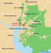
Map - Porto Alegre (Porto Alegre)
Map


Country - Brazil


Currency / Language
| ISO | Currency | Symbol | Significant figures |
|---|---|---|---|
| BRL | Brazilian real | R$ | 2 |
| ISO | Language |
|---|---|
| EN | English language |
| FR | French language |
| PT | Portuguese language |
| ES | Spanish language |